The late summer of 2021 brought devastating floods to New South Wales, Australia, marking the region’s worst flooding in six decades. Persistent, heavy rain fell for several days, leading to widespread inundation and displacement. The scale of the disaster was immense, with the Australian Bureau of Meteorology reporting staggering rainfall totals. Areas around Sydney and in the Hunter and Mid North Coast regions were drenched with 400 to 600 millimeters (16 to 24 inches) of rain across just four days, with some areas experiencing almost a meter of rainfall.
The impact was felt across numerous river systems. Water levels rose to major flood levels along the Clarence, Gwydir, Mehi, Lower Hunter, Manning, and Colo rivers, among others. The Hawkesbury-Nepean River system, which surrounds Sydney, saw its highest crests since 1961. The situation was compounded by the overflowing Warragamba Dam, which, as the BBC reported, discharged 500 gigalitres – equivalent to the volume of Sydney Harbour – into the already swollen river system. This, combined with natural choke points in the Hawkesbury-Nepean valley, created a “bathtub effect,” causing water to rapidly rise onto floodplains west of Sydney.
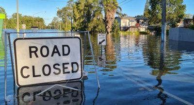
The consequences were devastating. At least 40,000 people were evacuated across NSW, and tragically, lives were lost. Farmers suffered significant crop and livestock losses, impacting livelihoods and food security.
We spent several days in the flooded region, covering the impact from numerous locations. Our team witnessed firsthand the sheer power of the floodwaters and the resilience of the communities affected. We captured stories of loss and hardship, but also of incredible community spirit and people helping each other in the face of adversity. Covering a natural disaster of this magnitude is a sobering experience. It highlights the vulnerability of communities to extreme weather events and the importance of preparedness and effective emergency management. We were honoured to play a role in bringing these stories to a wider audience, ensuring that the experiences of those affected were heard and that the scale of the disaster was understood. It was a challenging time, but we were determined to provide accurate and impactful reporting during this unprecedented event.